|
| *****SWAAG_ID***** | 190 |
| Date Entered | 15/05/2011 |
| Updated on | 15/05/2011 |
| Recorded by | Tim Laurie |
| Category | Burnt Mound |
| Record Type | Archaeology |
| Site Access | Army Range |
| Record Date | 06/02/2009 |
| Location | Dicky Edge West. Cordilleras Farm. |
| Civil Parish | Marske |
| Brit. National Grid | NZ 08800 03984 |
| Altitude | 348m |
| Geology | Richmond Cherts
|
| Record Name | Two burnt mounds above Dicky Edge (West). |
| Record Description | Two burnt mounds locate close together at the same spring, visible as low mounds of fire cracked sandstone. The larger site is crescentic in form 15m*10m, the smaller site is oval on plan, 9m*6m overall.
NZ08800 03984 and NZ08811 03998 |
| Dimensions | Larger mound 15m*8m. Smaller mound 9m*6m |
| Additional Notes | This large burnt mound complex is just 250m NE of the hut circle settlement on a terrace below the scar formed by the westward extension of Dickey Edge. (MSK18). The association between burnt mounds and hut circle settlements is widespread throughout Britain. |
| Image 1 ID | 652 Click image to enlarge |
| Image 1 Description | Burnt mound , the larger of two adjacent sites at this location, above round house settlement below Dicky Edge. | 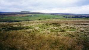 |
